
Ortler and Cevedale · 3,905 m
Ortler - Ortles
2 routes to a 3,905 m summit in the Ortler and Cevedale area, from PD+ (moderately difficult).
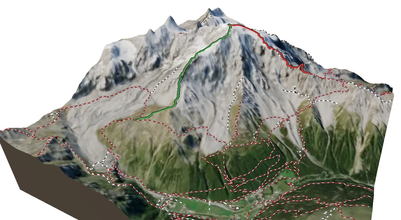
Overview
About Ortler - Ortles
Ortler - Ortles rises to 3,905 m in the Ortler and Cevedale area of the Alps, and is also known as Ortles and Ortler. The nearest village is Sulden - Solda at 1,847 m, about 4 km away, which leaves roughly 2,058 m of height between the valley and the top. The easiest way up is the Normal Route (from the Payer Hut), graded PD+ with rock moves up to III. The hardest of the 2 listed routes is the Hintergrat (SE Ridge) at AD. All of them come from guidebooks. Most parties spend a night at Payer Hütte (2,976 m), 2.2 km from the summit. 5 waymarked hikes start within 5 km, useful for acclimatising first.
Climbing
Routes to the summit
PD+
Normal Route (from the Payer Hut)
Moderately difficult · rock up to III
Guidebook
The normal route on the highest mountain in South Tyrol: rock steps, a glacier plateau and a long snow ridge.
- Grade
- PD+ · rock III
- Time
- 4–5 h from the hut
- Height gain
- 880 m
- Starts from
- Payerhütte (3029 m), from Sulden
On the route
- Tabaretta ridge rock steps with fixed aids
- Bärenloch rock passage (III-)
- Upper Ortler glacier
- Summit cross at 3905 m
Tips
- Icy in the morning: crampons for the rock steps
- Busy in high summer
- Crevasses on the upper glacier
AD
Hintergrat (SE Ridge)
Fairly difficult · rock up to III–IV
Guidebook
A long mixed ridge with snow crests and rock towers rising directly above Sulden.
- Grade
- AD · rock III–IV
- Time
- 5–6 h from the Hintergrat hut
- Height gain
- 1,240 m
- Starts from
- Hintergrathütte (2661 m)
On the route
- Snow crest in the lower part
- Signalkopf rock tower
- Exposed rock steps of III
Tips
- Better in good snow conditions
- Descend by the normal route to the Payer hut
Alpine grades: F easy · PD moderately difficult · AD fairly difficult · D difficult · TD very difficult. Roman numerals give the hardest rock moves.
The 3D atlas
Don’t just read about Ortler - Ortles. Fly around it.
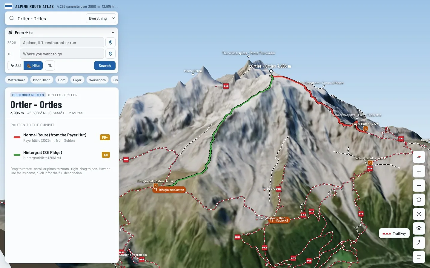
Every route on this page is traced on the real terrain in Berg Explorer. Spin the mountain, follow a ridge to the top and see which huts and lifts get you there.
- Turn and tilt every face in real 3D terrain
- Each route traced in colour, with its grade
- Huts, lifts and waymarked trails on the map
- Free, in your browser, no download
Where to stay
Huts for Ortler - Ortles
Nearby
Summits close by
Ortler Vorgipfel - Ortles Anticima
3,845 m · 0.3 km
Großeiskogel
3,547 m · 1.6 km
Coni di Ghiaccio
3,539 m · 1.6 km
Pleisshorn - Corno di Plaies
3,160 m · 1.7 km
See Ortler - Ortles in three dimensions
Open the 3D atlas