
Mountain hut · 2,197 m · ★ 5.0
Refuge du Plan de l'Aiguille
A staffed hut in the Mont Blanc massif area, and the start of 6 guidebook routes.
Overview
About the hut
Refuge du Plan de l'Aiguille is a staffed mountain hut at 2,197 m in the Mont Blanc massif area. The nearest village is Chamonix-Mont-Blanc (1,035 m), about 2 km away and 1,162 m lower. Climbers use it as the starting point for Mont Blanc, Mont Blanc du Tacul, Aiguille du Midi and Grandes Jorasses. The atlas rates it 5.0 out of 5, based on its position, altitude, access and the climbs around it. Book ahead in summer and check opening dates: many huts open only from late June to mid-September.
At a glance
Why stay, and what to know
Highlights
- Base for 31 summits over 3,000 m within 6 km, including Mont Blanc du Tacul, Pointe Durier, Triangle du Tacul
- Start of guidebook routes: Three Monts (Trois Monts) (Mont Blanc); Grands Mulets Route (Mont Blanc); Italian Normal Route (Aiguilles Grises) (Mont Blanc)
- Staffed hut: meals, drinks and a bed
- Easy access: about 0.5 km from the Aiguille du Midi 1 station
Good to know
- No obvious drawbacks in the data.
Climbing
Guidebook routes from the hut
AD-
Three Monts (Trois Monts)
Mont Blanc · 4,807 m
Guidebook
A high, glaciated traverse over the shoulders of Mont Blanc du Tacul and Mont Maudit. Often used as the descent of a traverse of the massif.
- Grade
- AD- · rock II, snow 45–50°
- Time
- 10–14 h from the Cosmiques hut
- Height gain
- 1,200 m
- Starts from
- Aiguille du Midi cable car (3842 m) / Cosmiques hut (3613 m)
On the route
- Serac-threatened north slopes of Mont Blanc du Tacul
- Steep slope (45–50°) to the Col du Mont Maudit
- Col de la Brenva (4303 m)
- The Mur de la Côte, a steep snow wall below the summit
Tips
- Serac fall and avalanche risk on the Tacul slopes; check recent conditions
- Not advisable after heavy snowfall or in warm weather
- Start by 1 am from the Cosmiques hut
PD-
Grands Mulets Route
Mont Blanc · 4,807 m
Guidebook
The historic route of the first ascent in 1786. Today mostly a ski-mountaineering line in spring because the Bossons glacier crossing has become dangerous.
- Grade
- PD- · rock I
- Time
- 2 days
- Height gain
- 2,490 m
- Starts from
- Plan de l'Aiguille (2317 m)
On the route
- Jonction of the Bossons and Taconnaz glaciers
- Grands Mulets hut (3051 m) on a rock island
- Petit and Grand Plateau, exposed to serac fall from the Dôme
- Joins the Bosses ridge at the Vallot shelter
Tips
- Best in spring on skis when the crevasses are bridged
- Serac fall from the Dôme du Goûter onto the Grand Plateau
- Glacier travel throughout: rope up
PD+
Italian Normal Route (Aiguilles Grises)
Mont Blanc · 4,807 m
Guidebook
The quiet Italian approach via the Dôme glacier and the Aiguilles Grises ridge, joining the Goûter route at the Dôme.
- Grade
- PD+ · rock II
- Time
- 2 days via the Gonella hut
- Height gain
- 1,740 m
- Starts from
- Rifugio Gonella (3071 m), from Val Veny
On the route
- Crevassed Dôme glacier
- Col des Aiguilles Grises (3810 m)
- Snow ridge to the Piton des Italiens
- Joins the Bosses ridge at the Vallot
Tips
- Far fewer people than the Goûter route
- The Gonella hut approach crosses the Miage glacier
- Glacier conditions vary; check with the hut
PD
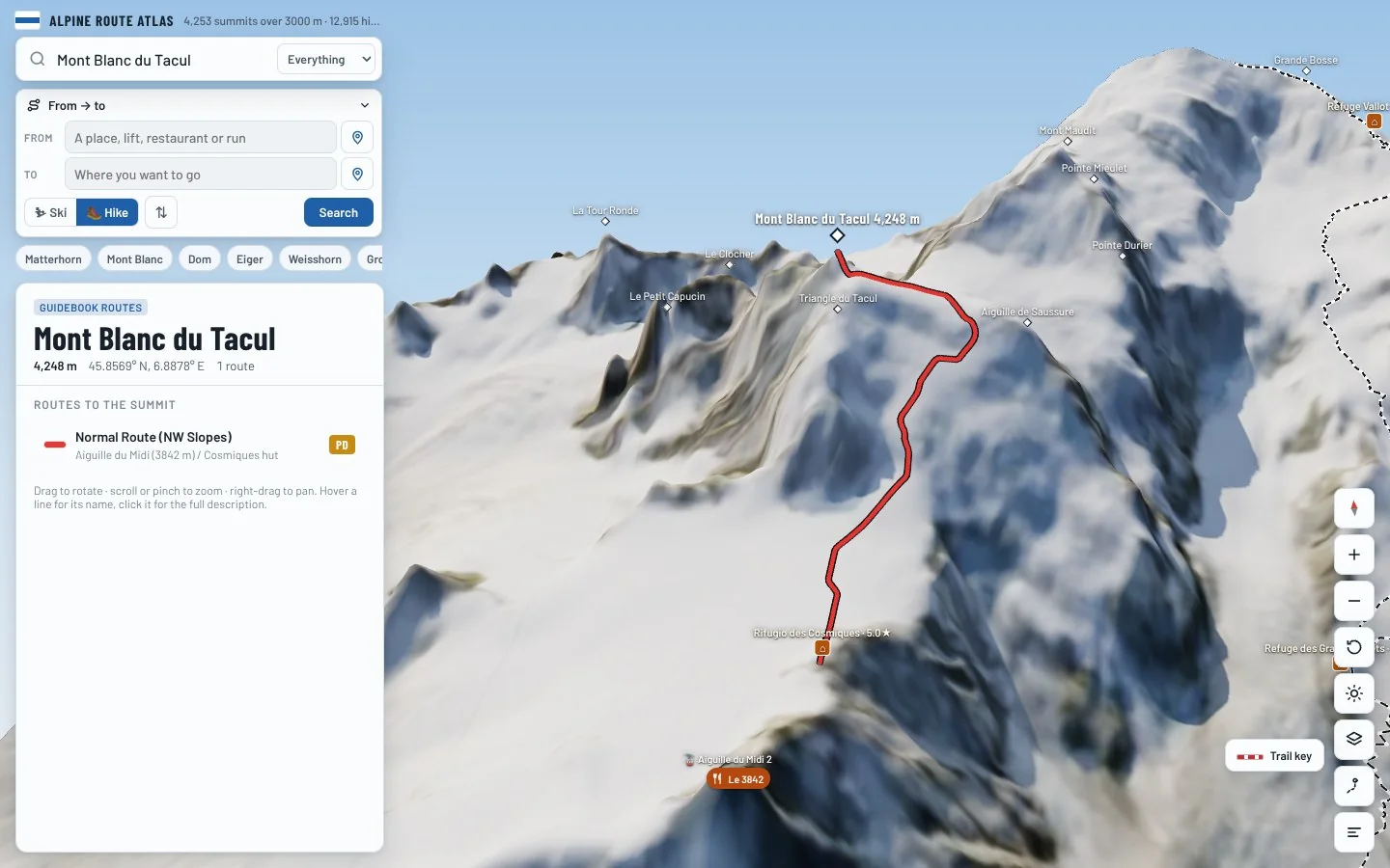
Normal Route (NW Slopes)
Mont Blanc du Tacul · 4,248 m
Guidebook
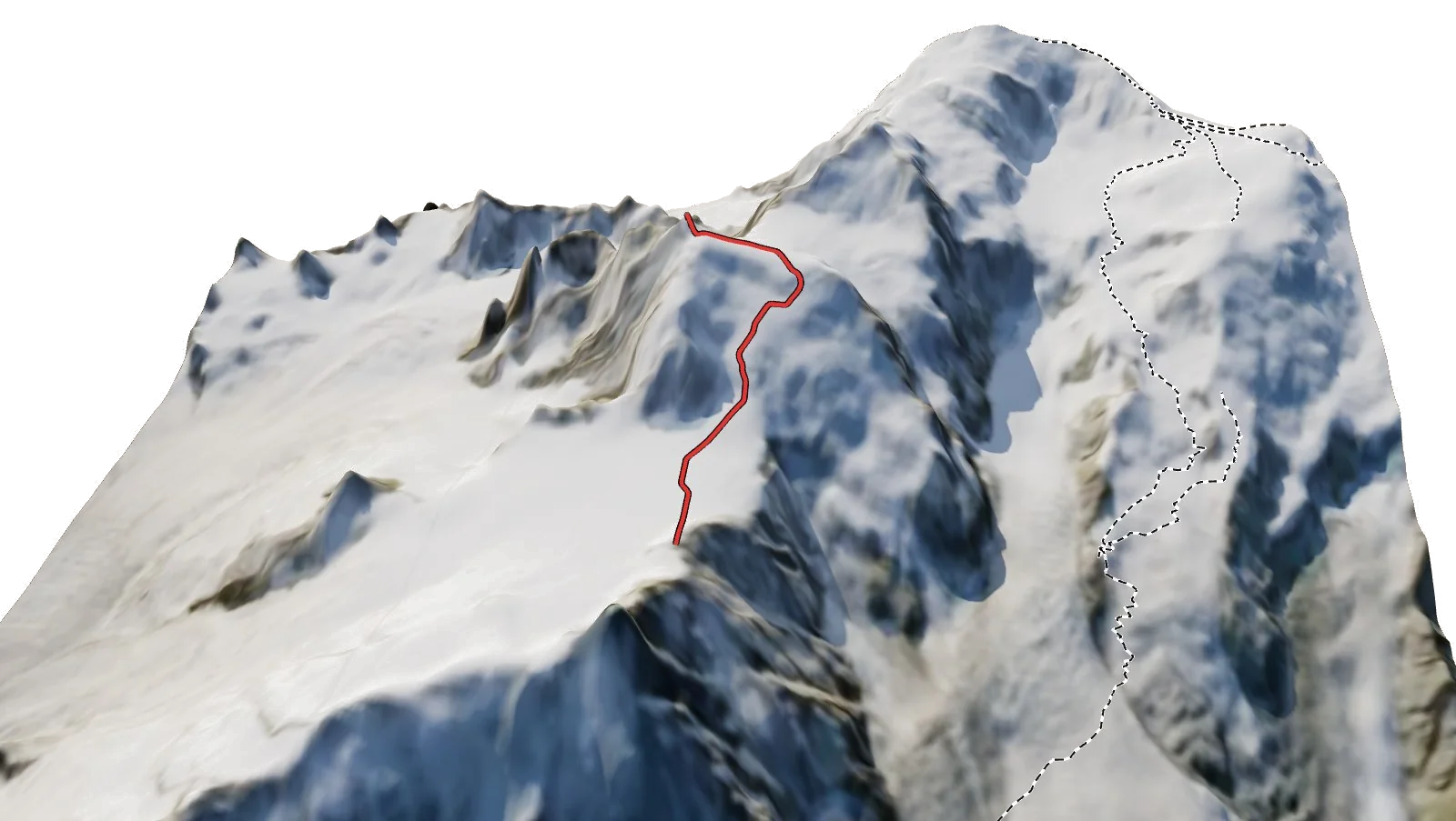
The first part of the Three Monts route, continuing to the summit of Mont Blanc du Tacul.
- Grade
- PD · rock I, snow 40°
- Time
- 3–4 h from the Cosmiques hut
- Height gain
- 640 m
- Starts from
- Aiguille du Midi (3842 m) / Cosmiques hut
On the route
- Serac barrier on the north-west slopes
- Steep snow at about 40°
- Rocky summit block
Tips
- Avalanche-prone after snowfall or wind
- Serac falls have killed several parties here
AD
Cosmiques Ridge (Arête des Cosmiques)
Aiguille du Midi · 3,842 m
Guidebook
A short, varied granite ridge ending on the Aiguille du Midi terrace. One of the most popular routes in Chamonix.
- Grade
- AD · rock III/IV-
- Time
- 3–4 h
- Height gain
- 230 m
- Starts from
- Aiguille du Midi cable car / Cosmiques hut (3613 m)
On the route
- Abseil into a gully
- Granite steps and slabs
- Ladder up to the cable car viewing terrace
Tips
- Queues in the afternoon; start early
- Check the last cable car down
AD
Normal Route (from the Boccalatte Hut)
Grandes Jorasses · 4,208 m
Guidebook
The Italian normal route, threatened by seracs and with steep rock and snow at the top.
- Grade
- AD · rock III
- Time
- 6–8 h from the hut
- Height gain
- 1,400 m
- Starts from
- Rifugio Boccalatte (2804 m), from Planpincieux
On the route
- Planpincieux glacier with active seracs
- Rochers Whymper rock rib
- Pointe Whymper and the final ridge to Pointe Walker
Tips
- The Planpincieux glacier has been closed at times due to serac collapse; check with the Courmayeur guides
- Climb the threatened section at night
The 3D atlas
Stand at the door and look up.
See exactly where Refuge du Plan de l'Aiguille sits on the mountain, which routes leave from it and how you reach it, on real 3D terrain.
- Turn and tilt every face in real 3D terrain
- Each route traced in colour, with its grade
- Huts, lifts and waymarked trails on the map
- Free, in your browser, no download
Nearby
Summits from here
On foot
Hikes starting nearby
- Plan de l'Aiguille - Montenvers6.9 km · +198 m
- Walker's Haute Route206.9 km · +15,698 m