
Dolomites · 388 km · 25 days
Via Alpina Yellow
A 25-day trek of 388 km in the Dolomites area, with 26,148 m of climbing.
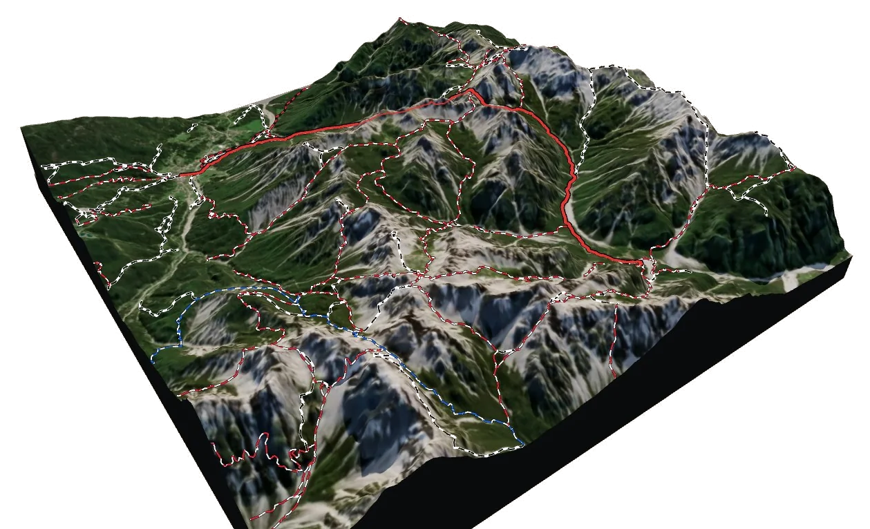
Overview
About Via Alpina Yellow
Via Alpina Yellow is an international long-distance trail in the Dolomites area, crossing Italy, Austria and Germany. It runs 387.8 km from the trail near Lorenzago di Cadore to the trail near Hinterhornbach. Along the way you climb 26,148 m and descend 25,483 m, between 673 m and a high point of 3,015 m. At a steady pace it takes about 184 h 15 of walking, usually split over 25 days. The hardest section is graded T3 on the Swiss hiking scale, demanding mountain hiking: a demanding path with steep, exposed sections and sometimes hands needed for balance; sure-footedness required. Most of it is easier, around T2. It is waymarked and looked after by via-alpina.org. 12 mountain huts are right on the route, so there are places to eat and sleep on the way. It passes over Pitztaler Jochköpfle, Kreuzjoch - Giogo della Croce and Col de Chi de Os.
On the trail
25 stages
Hard
Via Alpina Yellow B16
the trail near Lorenzago di Cadore → the trail above Caralte
13 km · 7 h 10
From the trail near Lorenzago di Cadore to the trail above Caralte.
- Distance
- 12.8 km
- Ascent
- +1,276 m
- Descent
- −924 m
- Walking time
- 7 h 10
- Highest point
- 2,060 m
- Lowest point
- 879 m
Medium
Via Alpina Yellow B17
the trail above Caralte → the trail above Domegge di Cadore
6 km · 5 h 55
From the trail above Caralte to the trail above Domegge di Cadore.
- Distance
- 6.5 km
- Ascent
- +1,032 m
- Descent
- −1,017 m
- Walking time
- 5 h 55
- Highest point
- 2,298 m
- Lowest point
- 1,269 m
Hard
Via Alpina Yellow B18
the trail above Domegge di Cadore → Rifugio Pietro Galassi città di Mestre
21 km · 8 h
From the trail above Domegge di Cadore to Rifugio Pietro Galassi città di Mestre. The day ends at Rifugio Pietro Galassi città di Mestre, a mountain hut: book ahead in summer.
- Distance
- 21.4 km
- Ascent
- +1,405 m
- Descent
- −672 m
- Walking time
- 8 h
- Highest point
- 2,017 m
- Lowest point
- 674 m
Hard
Via Alpina Yellow B19
Rifugio Pietro Galassi città di Mestre → Rifugio Citta di Fiume
18 km · 8 h 05
From Rifugio Pietro Galassi città di Mestre to Rifugio Citta di Fiume. The day ends at Rifugio Citta di Fiume, a mountain hut: book ahead in summer.
- Distance
- 18.2 km
- Ascent
- +1,152 m
- Descent
- −1,255 m
- Walking time
- 8 h 05
- Highest point
- 2,133 m
- Lowest point
- 1,004 m
Hard
Via Alpina Yellow B20
Rifugio Citta di Fiume → Pieve
24 km · 9 h 30
From Rifugio Citta di Fiume to Pieve.
- Distance
- 23.5 km
- Ascent
- +1,131 m
- Descent
- −1,579 m
- Walking time
- 9 h 30
- Highest point
- 2,353 m
- Lowest point
- 1,459 m
Medium
Via Alpina Yellow B21
Pieve → the trail above Arabba
16 km · 6 h 50
From Pieve to the trail above Arabba.
- Distance
- 15.9 km
- Ascent
- +1,268 m
- Descent
- −491 m
- Walking time
- 6 h 50
- Highest point
- 2,343 m
- Lowest point
- 1,377 m
Medium
Via Alpina Yellow B22
the trail above Arabba → Rifugio Contrin
18 km · 6 h 55
From the trail above Arabba to Rifugio Contrin. The day ends at Rifugio Contrin, a mountain hut: book ahead in summer.
- Distance
- 18.3 km
- Ascent
- +834 m
- Descent
- −1,066 m
- Walking time
- 6 h 55
- Highest point
- 2,426 m
- Lowest point
- 1,494 m
Hard
Via Alpina Yellow B23
Rifugio Contrin → the trail near Mazzin - Mazin
14 km · 7 h
From Rifugio Contrin to the trail near Mazzin - Mazin.
- Distance
- 14.3 km
- Ascent
- +792 m
- Descent
- −1,418 m
- Walking time
- 7 h
- Highest point
- 2,502 m
- Lowest point
- 1,387 m
Medium
Via Alpina Yellow B24
the trail near Mazzin - Mazin → the trail above Mazzin - Mazin
7 km · 4 h 25
From the trail near Mazzin - Mazin to the trail above Mazzin - Mazin.
- Distance
- 7.4 km
- Ascent
- +1,109 m
- Descent
- −27 m
- Walking time
- 4 h 25
- Highest point
- 2,505 m
- Lowest point
- 1,410 m
Medium
Via Alpina Yellow B25
the trail above Mazzin - Mazin → the trail above Weisslahnbad - Lavina Bianca
12 km · 6 h
From the trail above Mazzin - Mazin to the trail above Weisslahnbad - Lavina Bianca.
- Distance
- 11.9 km
- Ascent
- +851 m
- Descent
- −892 m
- Walking time
- 6 h
- Highest point
- 2,764 m
- Lowest point
- 2,347 m
Medium
Via Alpina Yellow B26
the trail above Weisslahnbad - Lavina Bianca → Tiers - Tires
11 km · 6 h 15
From the trail above Weisslahnbad - Lavina Bianca to Tiers - Tires.
- Distance
- 11.4 km
- Ascent
- +406 m
- Descent
- −1,838 m
- Walking time
- 6 h 15
- Highest point
- 2,453 m
- Lowest point
- 1,001 m
Medium
Via Alpina Yellow B27
Tiers - Tires → the trail above Falzeben
20 km · 7 h
From Tiers - Tires to the trail above Falzeben.
- Distance
- 20.0 km
- Ascent
- +1,241 m
- Descent
- −361 m
- Walking time
- 7 h
- Highest point
- 2,081 m
- Lowest point
- 1,061 m
Medium
Via Alpina Yellow B28
the trail above Falzeben → Schutzhaus Hochgang
18 km · 6 h
From the trail above Falzeben to Schutzhaus Hochgang. The day ends at Schutzhaus Hochgang, a mountain hut: book ahead in summer.
- Distance
- 18.1 km
- Ascent
- +648 m
- Descent
- −750 m
- Walking time
- 6 h
- Highest point
- 1,941 m
- Lowest point
- 1,363 m
Medium
Via Alpina Yellow B29
Schutzhaus Hochgang → the trail above Staben - Stava
16 km · 6 h 45
From Schutzhaus Hochgang to the trail above Staben - Stava.
- Distance
- 15.8 km
- Ascent
- +822 m
- Descent
- −1,195 m
- Walking time
- 6 h 45
- Highest point
- 1,885 m
- Lowest point
- 1,373 m
Medium
Via Alpina Yellow B30
the trail above Staben - Stava → Karthaus - Certosa di Senales
10 km · 4 h 30
From the trail above Staben - Stava to Karthaus - Certosa di Senales.
- Distance
- 10.1 km
- Ascent
- +599 m
- Descent
- −756 m
- Walking time
- 4 h 30
- Highest point
- 1,506 m
- Lowest point
- 955 m
Hard
Via Alpina Yellow B31
Karthaus - Certosa di Senales → Similaunhutte
13 km · 7 h 35
From Karthaus - Certosa di Senales to Similaunhutte. The day ends at Similaunhutte, a mountain hut: book ahead in summer.
- Distance
- 12.9 km
- Ascent
- +1,846 m
- Descent
- −183 m
- Walking time
- 7 h 35
- Highest point
- 3,014 m
- Lowest point
- 1,350 m
Medium
Via Alpina Yellow B32
Similaunhutte → Vent
12 km · 4 h 10
From Similaunhutte to Vent.
- Distance
- 12.4 km
- Ascent
- +27 m
- Descent
- −1,144 m
- Walking time
- 4 h 10
- Highest point
- 3,015 m
- Lowest point
- 1,893 m
Hard
Via Alpina Yellow B33
Vent → Zwieselstein
19 km · 8 h 40
From Vent to Zwieselstein.
- Distance
- 19.4 km
- Ascent
- +1,049 m
- Descent
- −1,487 m
- Walking time
- 8 h 40
- Highest point
- 2,801 m
- Lowest point
- 1,463 m
Hard
Via Alpina Yellow B34
Zwieselstein → the trail above Plangeross
16 km · 7 h 55
From Zwieselstein to the trail above Plangeross.
- Distance
- 16.5 km
- Ascent
- +1,653 m
- Descent
- −360 m
- Walking time
- 7 h 55
- Highest point
- 2,983 m
- Lowest point
- 1,463 m
Hard
Via Alpina Yellow B35
the trail above Plangeross → Wenns
38 km · 12 h 20
From the trail above Plangeross to Wenns.
- Distance
- 38.2 km
- Ascent
- +595 m
- Descent
- −2,347 m
- Walking time
- 12 h 20
- Highest point
- 2,754 m
- Lowest point
- 952 m
Hard
Via Alpina Yellow B36
Wenns → Zams
19 km · 11 h
From Wenns to Zams.
- Distance
- 19.3 km
- Ascent
- +1,707 m
- Descent
- −1,786 m
- Walking time
- 11 h
- Highest point
- 2,499 m
- Lowest point
- 778 m
Hard
Via Alpina Yellow B37
Zams → the trail above Grins
14 km · 8 h 35
From Zams to the trail above Grins.
- Distance
- 13.6 km
- Ascent
- +1,980 m
- Descent
- −512 m
- Walking time
- 8 h 35
- Highest point
- 2,589 m
- Lowest point
- 761 m
Medium
Via Alpina Yellow B38
the trail above Grins → Holzgau
16 km · 5 h 25
From the trail above Grins to Holzgau.
- Distance
- 16.3 km
- Ascent
- +141 m
- Descent
- −1,288 m
- Walking time
- 5 h 25
- Highest point
- 2,235 m
- Lowest point
- 1,066 m
Medium
Via Alpina Yellow B39
Holzgau → Kemptner Hütte
7 km · 4 h 35
From Holzgau to Kemptner Hütte. The day ends at Kemptner Hütte, a mountain hut: book ahead in summer.
- Distance
- 7.3 km
- Ascent
- +1,043 m
- Descent
- −300 m
- Walking time
- 4 h 35
- Highest point
- 1,970 m
- Lowest point
- 1,101 m
Medium
Via Alpina Yellow B40
Kemptner Hütte → the trail near Hinterhornbach
13 km · 4 h 30
From Kemptner Hütte to the trail near Hinterhornbach.
- Distance
- 13.2 km
- Ascent
- +150 m
- Descent
- −1,161 m
- Walking time
- 4 h 30
- Highest point
- 1,841 m
- Lowest point
- 830 m
Times are for a steady walker without long breaks, worked out like the atlas does from distance, climb and altitude. Swiss hiking scale: T1 hiking · T2 mountain hiking · T3 demanding mountain hiking · T4 alpine hiking · T5–T6 demanding alpine routes.
The 3D atlas
Walk Via Alpina Yellow before you go.
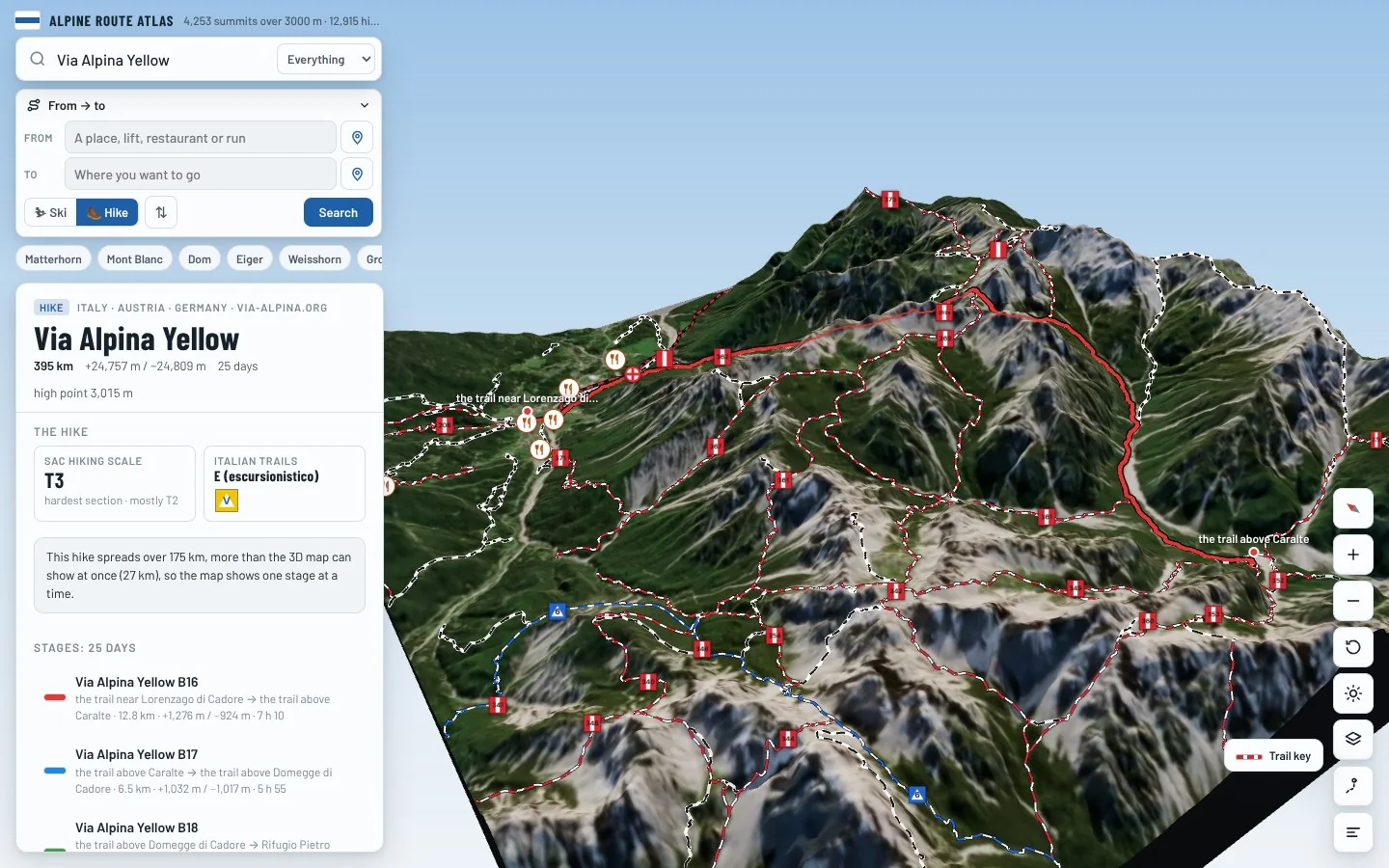
Follow every stage on real 3D terrain in Berg Explorer: see the climbs, the passes and the huts where each day ends.
- Turn and tilt every face in real 3D terrain
- Each route traced in colour, with its grade
- Huts, lifts and waymarked trails on the map
- Free, in your browser, no download
Where to stay
Huts on the route
Nearby
Summits close by
Cima Fanton
3,140 m · 24 km from the start
Punta Chiggiato
3,163 m · 24 km from the start
Punta Menini
3,168 m · 24 km from the start
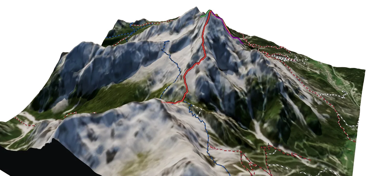
Antelao
3,264 m · 25 km from the start
See Via Alpina Yellow in three dimensions
Open the 3D atlas