
Mont Blanc massif · 259 km · 16 days
Sulle strade dei valdesi: GRV Glorioso Rimpatrio dei Valdesi
A 16-day trek of 259 km in the Mont Blanc massif area, with 14,359 m of climbing.
Overview
About Sulle strade dei valdesi: GRV Glorioso Rimpatrio dei Valdesi
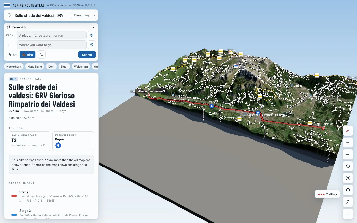
Sulle strade dei valdesi: GRV Glorioso Rimpatrio dei Valdesi is an international long-distance trail in the Mont Blanc massif area, crossing France and Italy. It runs 259.4 km from the trail near Nancy-sur-Cluses to Bobbio Pellice. Along the way you climb 14,359 m and descend 14,050 m, between 504 m and a high point of 2,762 m. At a steady pace it takes about 106 h 50 of walking, usually split over 16 days. The hardest section is graded T2 on the Swiss hiking scale, mountain hiking: a marked mountain path, partly steep, with some exposed bits; walking boots needed. Most of it is easier, around T1. It is waymarked as GRV. 8 mountain huts are right on the route, so there are places to eat and sleep on the way.
On the trail
17 stages
Medium
Stage 1
the trail near Nancy-sur-Cluses → Demi-Quartier
19 km · 5 h 40
From the trail near Nancy-sur-Cluses to Demi-Quartier.
- Distance
- 18.7 km
- Ascent
- +717 m
- Descent
- −148 m
- Walking time
- 5 h 40
- Highest point
- 1,086 m
- Lowest point
- 505 m
Medium
Stage 2
Demi-Quartier → Refuge de la Croix de Pierre
14 km · 4 h 45
From Demi-Quartier to Refuge de la Croix de Pierre. The day ends at Refuge de la Croix de Pierre, a mountain hut: book ahead in summer.
- Distance
- 13.6 km
- Ascent
- +957 m
- Descent
- −75 m
- Walking time
- 4 h 45
- Highest point
- 1,968 m
- Lowest point
- 1,086 m
Medium
Stage 3
Refuge de la Croix de Pierre → the trail above Hauteluce
14 km · 6 h 05
From Refuge de la Croix de Pierre to the trail above Hauteluce.
- Distance
- 14.2 km
- Ascent
- +1,007 m
- Descent
- −624 m
- Walking time
- 6 h 05
- Highest point
- 2,351 m
- Lowest point
- 1,815 m
Medium
Stage 4
the trail above Hauteluce → the trail near Séez
17 km · 6 h
From the trail above Hauteluce to the trail near Séez.
- Distance
- 17.2 km
- Ascent
- +208 m
- Descent
- −1,580 m
- Walking time
- 6 h
- Highest point
- 2,479 m
- Lowest point
- 979 m
Medium
Stage 5
the trail near Séez → the trail above Sainte-Foy-Tarentaise
18 km · 6 h 05
From the trail near Séez to the trail above Sainte-Foy-Tarentaise.
- Distance
- 17.5 km
- Ascent
- +910 m
- Descent
- −546 m
- Walking time
- 6 h 05
- Highest point
- 1,343 m
- Lowest point
- 833 m
Medium
Stage 6
the trail above Sainte-Foy-Tarentaise → Tignes
14 km · 6 h
From the trail above Sainte-Foy-Tarentaise to Tignes.
- Distance
- 13.9 km
- Ascent
- +1,165 m
- Descent
- −383 m
- Walking time
- 6 h
- Highest point
- 2,127 m
- Lowest point
- 1,327 m
Medium
Stage 7
Tignes → the trail above Bonneval-sur-Arc
14 km · 6 h
From Tignes to the trail above Bonneval-sur-Arc.
- Distance
- 14.3 km
- Ascent
- +1,081 m
- Descent
- −446 m
- Walking time
- 6 h
- Highest point
- 2,760 m
- Lowest point
- 1,793 m
Medium
Stage 8
the trail above Bonneval-sur-Arc → the trail above Lanslevillard
19 km · 5 h 50
From the trail above Bonneval-sur-Arc to the trail above Lanslevillard.
- Distance
- 18.6 km
- Ascent
- +144 m
- Descent
- −1,156 m
- Walking time
- 5 h 50
- Highest point
- 2,761 m
- Lowest point
- 1,677 m
Medium
Stage 9
the trail above Lanslevillard → Refuge du Petit Mont Cenis
14 km · 4 h 45
From the trail above Lanslevillard to Refuge du Petit Mont Cenis. The day ends at Refuge du Petit Mont Cenis, a mountain hut: book ahead in summer.
- Distance
- 14.1 km
- Ascent
- +704 m
- Descent
- −328 m
- Walking time
- 4 h 45
- Highest point
- 2,124 m
- Lowest point
- 1,461 m
Medium
Stage 10
Refuge du Petit Mont Cenis → the trail near Ramats
13 km · 6 h
From Refuge du Petit Mont Cenis to the trail near Ramats.
- Distance
- 12.9 km
- Ascent
- +476 m
- Descent
- −1,473 m
- Walking time
- 6 h
- Highest point
- 2,473 m
- Lowest point
- 1,127 m
Medium
Stage 11
the trail near Ramats → the trail above Exilles
11 km · 6 h 05
From the trail near Ramats to the trail above Exilles.
- Distance
- 11.0 km
- Ascent
- +1,147 m
- Descent
- −647 m
- Walking time
- 6 h 05
- Highest point
- 2,097 m
- Lowest point
- 1,084 m
Medium
Stage 12
the trail above Exilles → the trail above Sauze d'Oulx
10 km · 6 h
From the trail above Exilles to the trail above Sauze d'Oulx.
- Distance
- 10.1 km
- Ascent
- +1,027 m
- Descent
- −875 m
- Walking time
- 6 h
- Highest point
- 1,779 m
- Lowest point
- 1,012 m
Medium
Stage 13
the trail above Sauze d'Oulx → Rifugio Mulino di Laval
14 km · 6 h
From the trail above Sauze d'Oulx to Rifugio Mulino di Laval. The day ends at Rifugio Mulino di Laval, a mountain hut: book ahead in summer.
- Distance
- 14.4 km
- Ascent
- +813 m
- Descent
- −918 m
- Walking time
- 6 h
- Highest point
- 2,312 m
- Lowest point
- 1,529 m
Medium
Stage 14
Rifugio Mulino di Laval → the trail above Pelhoun
13 km · 6 h
From Rifugio Mulino di Laval to the trail above Pelhoun.
- Distance
- 13.2 km
- Ascent
- +938 m
- Descent
- −742 m
- Walking time
- 6 h
- Highest point
- 2,597 m
- Lowest point
- 1,674 m
Medium
Stage 15
the trail above Pelhoun → Rodoretto / Rooudouret
14 km · 6 h 05
From the trail above Pelhoun to Rodoretto / Rooudouret.
- Distance
- 13.8 km
- Ascent
- +784 m
- Descent
- −1,066 m
- Walking time
- 6 h 05
- Highest point
- 1,870 m
- Lowest point
- 1,122 m
Medium
Stage 16
Rodoretto / Rooudouret → the trail above Bobbio Pellice
12 km · 6 h 05
From Rodoretto / Rooudouret to the trail above Bobbio Pellice.
- Distance
- 12.4 km
- Ascent
- +1,129 m
- Descent
- −583 m
- Walking time
- 6 h 05
- Highest point
- 2,447 m
- Lowest point
- 1,450 m
Easy
Stage 17
the trail above Bobbio Pellice → Bobbio Pellice
7 km · 3 h 30
From the trail above Bobbio Pellice to Bobbio Pellice.
- Distance
- 7.0 km
- Ascent
- +12 m
- Descent
- −1,320 m
- Walking time
- 3 h 30
- Highest point
- 2,134 m
- Lowest point
- 826 m
Times are for a steady walker without long breaks, worked out like the atlas does from distance, climb and altitude. Swiss hiking scale: T1 hiking · T2 mountain hiking · T3 demanding mountain hiking · T4 alpine hiking · T5–T6 demanding alpine routes.
The 3D atlas
Walk Sulle strade dei valdesi: GRV Glorioso Rimpatrio dei Valdesi before you go.
Follow every stage on real 3D terrain in Berg Explorer: see the climbs, the passes and the huts where each day ends.
- Turn and tilt every face in real 3D terrain
- Each route traced in colour, with its grade
- Huts, lifts and waymarked trails on the map
- Free, in your browser, no download
Where to stay
Huts on the route
Refuge de la Croix de Pierre
1,963 m · ★ 3.0
Refuge du Prariond Par les Gorges de Malpasset
1,873 m · ★ 3.5
Refuge du Petit Mont Cenis
2,125 m · ★ 3.5
Bivacco Transfrontaliero Col Clapier Bivouac Hannibal
2,500 m · ★ 3.5
Rifugio Lago Delle Rane
1,809 m · ★ 3.0
la capanna del sole/la capanna della luna
1,591 m · ★ 2.5
Nearby
Summits close by
Mont Buet
3,096 m · 19 km from the start
Mont Ruan
3,054 m · 25 km from the start
Tour Sallière
3,220 m · 26 km from the start
Pointe Centrale
3,061 m · 26 km from the start