
Zermatt and Saas · 293 km · 24 days
Grande Traversata delle Alpi
A 24-day trek of 293 km in the Zermatt and Saas area, with 24,477 m of climbing.
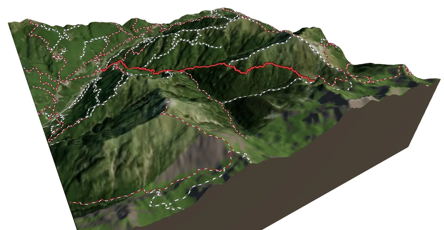
Overview
About Grande Traversata delle Alpi
Grande Traversata delle Alpi is a national long-distance trail in the Zermatt and Saas area in Italy. It runs 292.7 km from Calasca to Susa. Along the way you climb 24,477 m and descend 23,821 m, between 452 m and a high point of 2,631 m. At a steady pace it takes about 164 h 05 of walking, usually split over 24 days. The hardest section is graded T3 on the Swiss hiking scale, demanding mountain hiking: a demanding path with steep, exposed sections and sometimes hands needed for balance; sure-footedness required. Most of it is easier, around T2. 8 mountain huts are right on the route, so there are places to eat and sleep on the way.
On the trail
24 stages
Medium
GTA: Molini di Calasca - Alpe del Lago
Calasca → the trail above Piana di Forno
8 km · 4 h 55
From Calasca to the trail above Piana di Forno.
- Distance
- 7.7 km
- Ascent
- +1,256 m
- Descent
- −162 m
- Walking time
- 4 h 55
- Highest point
- 1,617 m
- Lowest point
- 453 m
Medium
GTA: Alpe del Lago - Campello Monti
the trail above Piana di Forno → the trail above Piana di Forno
8 km · 4 h 50
From the trail above Piana di Forno to the trail above Piana di Forno.
- Distance
- 8.2 km
- Ascent
- +682 m
- Descent
- −889 m
- Walking time
- 4 h 50
- Highest point
- 2,029 m
- Lowest point
- 1,344 m
Medium
GTA: Campello Monti - Rimella
the trail above Piana di Forno → Rimella
8 km · 4 h 25
From the trail above Piana di Forno to Rimella.
- Distance
- 8.4 km
- Ascent
- +607 m
- Descent
- −797 m
- Walking time
- 4 h 25
- Highest point
- 1,918 m
- Lowest point
- 1,158 m
Medium
GTA: Rimella - Alpe Baranca
Rimella → Rifugio Alpe Baranca
10 km · 5 h 20
From Rimella to Rifugio Alpe Baranca. The day ends at Rifugio Alpe Baranca, a mountain hut: book ahead in summer.
- Distance
- 9.9 km
- Ascent
- +1,019 m
- Descent
- −586 m
- Walking time
- 5 h 20
- Highest point
- 1,584 m
- Lowest point
- 979 m
Medium
GTA: Alpe Baranca - Carcoforo
Rifugio Alpe Baranca → Carcoforo
9 km · 4 h 55
From Rifugio Alpe Baranca to Carcoforo.
- Distance
- 8.6 km
- Ascent
- +666 m
- Descent
- −958 m
- Walking time
- 4 h 55
- Highest point
- 2,240 m
- Lowest point
- 1,296 m
Medium
GTA: Carcoforo - Rima
Carcoforo → Rima
8 km · 5 h 55
From Carcoforo to Rima.
- Distance
- 8.5 km
- Ascent
- +985 m
- Descent
- −928 m
- Walking time
- 5 h 55
- Highest point
- 2,347 m
- Lowest point
- 1,362 m
Hard
GTA: Rima - Sant'Antonio di Valvogna
Rima → Riva Valdobbia / Riifu
14 km · 7 h 25
From Rima to Riva Valdobbia / Riifu.
- Distance
- 14.1 km
- Ascent
- +1,068 m
- Descent
- −1,263 m
- Walking time
- 7 h 25
- Highest point
- 2,328 m
- Lowest point
- 1,108 m
Medium
GTA: Sant'Antonio di Valvogna - Rifugio Rivetti
Riva Valdobbia / Riifu → Rifugio Alfredo Rivetti
15 km · 6 h 45
From Riva Valdobbia / Riifu to Rifugio Alfredo Rivetti. The day ends at Rifugio Alfredo Rivetti, a mountain hut: book ahead in summer.
- Distance
- 14.7 km
- Ascent
- +1,298 m
- Descent
- −490 m
- Walking time
- 6 h 45
- Highest point
- 2,486 m
- Lowest point
- 1,362 m
Medium
GTA: Rifugio Rivetti - Santuario San Giovanni
Rifugio Alfredo Rivetti → Campiglia Cervo
13 km · 6 h 50
From Rifugio Alfredo Rivetti to Campiglia Cervo.
- Distance
- 12.6 km
- Ascent
- +611 m
- Descent
- −1,781 m
- Walking time
- 6 h 50
- Highest point
- 2,187 m
- Lowest point
- 883 m
Medium
GTA: Santuario San Giovanni - Oropa
Campiglia Cervo → the trail above Favaro
10 km · 4 h 40
From Campiglia Cervo to the trail above Favaro.
- Distance
- 9.6 km
- Ascent
- +784 m
- Descent
- −622 m
- Walking time
- 4 h 40
- Highest point
- 1,620 m
- Lowest point
- 1,019 m
Medium
GTA: Oropa - Rifugio Coda
the trail above Favaro → Rifugio Coda
9 km · 5 h 05
From the trail above Favaro to Rifugio Coda. The day ends at Rifugio Coda, a mountain hut: book ahead in summer.
- Distance
- 9.2 km
- Ascent
- +1,217 m
- Descent
- −149 m
- Walking time
- 5 h 05
- Highest point
- 2,250 m
- Lowest point
- 1,182 m
Medium
GTA: Rifugio Coda - Maletto
Rifugio Coda → the trail above Lillianes
5 km · 2 h
From Rifugio Coda to the trail above Lillianes.
- Distance
- 4.7 km
- Ascent
- +181 m
- Descent
- −431 m
- Walking time
- 2 h
- Highest point
- 2,248 m
- Lowest point
- 1,998 m
Medium
GTA: Le Capanne - Fondo
the trail above Lillianes → the trail above Traversella
12 km · 6 h 35
From the trail above Lillianes to the trail above Traversella.
- Distance
- 12.5 km
- Ascent
- +895 m
- Descent
- −1,215 m
- Walking time
- 6 h 35
- Highest point
- 2,058 m
- Lowest point
- 1,038 m
Hard
GTA: Le Fondo - Piamprato
the trail above Traversella → Piamprato
12 km · 7 h 10
From the trail above Traversella to Piamprato.
- Distance
- 11.9 km
- Ascent
- +1,340 m
- Descent
- −857 m
- Walking time
- 7 h 10
- Highest point
- 2,407 m
- Lowest point
- 1,067 m
Medium
GTA: Piamprato - Ronco Canavese
Piamprato → Ronco Canavese
14 km · 5 h 20
From Piamprato to Ronco Canavese.
- Distance
- 14.3 km
- Ascent
- +500 m
- Descent
- −1,100 m
- Walking time
- 5 h 20
- Highest point
- 1,567 m
- Lowest point
- 947 m
Medium
GTA: Ronco Canavese - Talosio
Ronco Canavese → the trail near Ribordone
12 km · 6 h 55
From Ronco Canavese to the trail near Ribordone.
- Distance
- 11.9 km
- Ascent
- +1,218 m
- Descent
- −932 m
- Walking time
- 6 h 55
- Highest point
- 2,086 m
- Lowest point
- 884 m
Hard
GTA: Talosio - San Lorenzo
the trail near Ribordone → the trail above Rosone
13 km · 8 h 50
From the trail near Ribordone to the trail above Rosone.
- Distance
- 13.0 km
- Ascent
- +1,384 m
- Descent
- −1,540 m
- Walking time
- 8 h 50
- Highest point
- 2,184 m
- Lowest point
- 1,070 m
Medium
GTA: San Lorenzo - Noasca
the trail above Rosone → Noasca
12 km · 5 h 20
From the trail above Rosone to Noasca.
- Distance
- 11.6 km
- Ascent
- +851 m
- Descent
- −733 m
- Walking time
- 5 h 20
- Highest point
- 1,522 m
- Lowest point
- 896 m
Medium
GTA: Noasca - Ceresole Reale
Noasca → Prese-Montone
10 km · 5 h 20
From Noasca to Prese-Montone.
- Distance
- 10.3 km
- Ascent
- +1,009 m
- Descent
- −567 m
- Walking time
- 5 h 20
- Highest point
- 2,008 m
- Lowest point
- 1,062 m
Hard
GTA: Ceresole Reale - Pialpetta
Prese-Montone → Pialpetta
13 km · 8 h 10
From Prese-Montone to Pialpetta.
- Distance
- 13.0 km
- Ascent
- +1,133 m
- Descent
- −1,561 m
- Walking time
- 8 h 10
- Highest point
- 2,631 m
- Lowest point
- 1,071 m
Hard
GTAC13
Pialpetta → Balme
15 km · 8 h 45
From Pialpetta to Balme.
- Distance
- 15.1 km
- Ascent
- +1,535 m
- Descent
- −1,161 m
- Walking time
- 8 h 45
- Highest point
- 2,471 m
- Lowest point
- 1,040 m
Hard
GTA: Balme - Usseglio
Balme → Usseglio
16 km · 8 h 30
From Balme to Usseglio.
- Distance
- 15.8 km
- Ascent
- +1,252 m
- Descent
- −1,419 m
- Walking time
- 8 h 30
- Highest point
- 2,440 m
- Lowest point
- 1,259 m
Hard
GTA: Usseglio - Il Truc
Usseglio → the trail above Mompantero
27 km · 10 h 45
From Usseglio to the trail above Mompantero.
- Distance
- 27.0 km
- Ascent
- +1,665 m
- Descent
- −1,240 m
- Walking time
- 10 h 45
- Highest point
- 2,542 m
- Lowest point
- 1,284 m
Medium
GTA: Il Truc - Susa
the trail above Mompantero → Susa
8 km · 3 h 30
From the trail above Mompantero to Susa.
- Distance
- 8.4 km
- Ascent
- +25 m
- Descent
- −1,233 m
- Walking time
- 3 h 30
- Highest point
- 1,705 m
- Lowest point
- 493 m
Times are for a steady walker without long breaks, worked out like the atlas does from distance, climb and altitude. Swiss hiking scale: T1 hiking · T2 mountain hiking · T3 demanding mountain hiking · T4 alpine hiking · T5–T6 demanding alpine routes.
The 3D atlas
Walk Grande Traversata delle Alpi before you go.
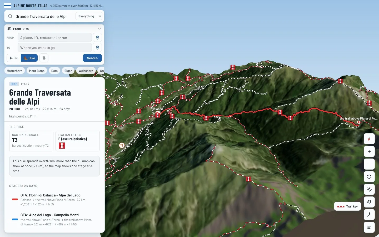
Follow every stage on real 3D terrain in Berg Explorer: see the climbs, the passes and the huts where each day ends.
- Turn and tilt every face in real 3D terrain
- Each route traced in colour, with its grade
- Huts, lifts and waymarked trails on the map
- Free, in your browser, no download
Where to stay
Huts on the route
Nearby
Summits close by
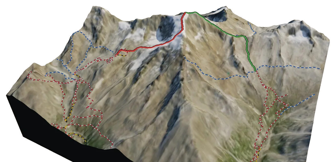
See Grande Traversata delle Alpi in three dimensions
Open the 3D atlas